Use of public GNSS observation data at gnss.go.jp
Introduction
The Cabinet Office of Japan started operation of the GNSS integrated data sharing system, MIRAI (Multi-GNSS Integrated Real time and Archived Information system), on April 1, 2022. It provides archives and real-time data of GNSS (global navigation satellite system) observation data in various regions. Anyone can use it for free. The web page is very elaborate and overwhelming.
MIRAI is a system that collects and distributes data from monitoring stations located all over the world. The user (registration required) can check the status of the monitoring station connected to MIRAI on the Web browser, receive the monitoring station’s real-time data (RTCM 3), and download the archive data (RINEX).
It may not be a substitute for the RTK reference station service, but it is a great collection of data from around the world.

Account creation
Click the “Sign up / Login” link in the upper right to create an account. Through account creation, real name was not asked. To create an account, we provide
- nickname (alphabet, number, symbol, or a combination of these)
- organization (I think it’s good as an individual)
- country (Choice)
- e-mail address
- Password (8 to 30 characters including one or more lowercase letters, uppercase letters, and numbers)
On the bottom, there are check boxes of
- subscribe information for this website
- subscribe status for MIRAI service
- subscribe status of each GNSS station
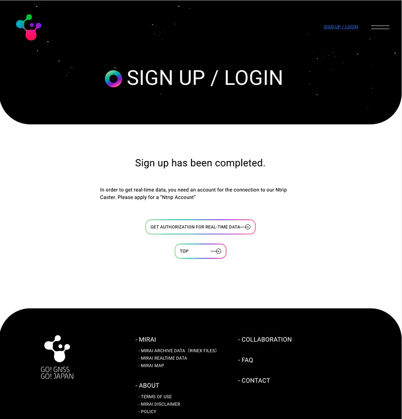
but I recommend unchecked at the bottom one. Clicking the link in the confirmation e-mail, you will complete the registration.
If you check “subscribe status of each GNSS station”, you will receive many e-mails such as the following. You can change each e-mail subscription setting on the user page.
# GNSS Station Operational Status
# 01 Apr 2022 10:40:02 (UTC)
# NOTICE! This E-mail may be sent frequently due to the existence of stations with unstable communication.

KILK00AUS:Stop -> Active
CPVG00CPV:Active -> Stop
7DLN00AUS:Stop -> Active
Use of archive data
An archive of observation data is available from the “GET ARCHIVE DATA” link. The observation data is a RINEX 3.04 format file compressed in Hatanaka Compact RINEX format and then gzip-compressed. You can download it from your browser. You can also download it with curl as follows if you know the file name. Please replace email-address and password with your own.
curl -O -u email-address:password https://go.gnss.go.jp/rinex/daily/2022/001/22d/QSPP00JPN_R_20220010000_01D_30S_MO.crx.gz
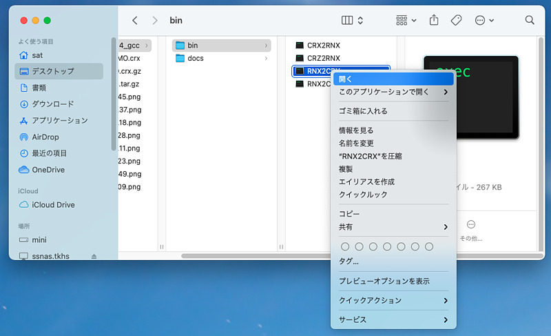
After decompressing this observation data file with gunzip, you can convert the Hatanaka compact RINEX format file (extension crx) to the commonly used RINEX format file (extension rnx). Click the link on the page to get the conversion tools of Hatanaka compact RINEX files (crx2rnx, crz2rnx, rnx2crx, rnx2crz). Here, crx2rnx is used to obtain 000200JPN_R_20220010000_01D_30S_MO.rnx .
gunzip 000200JPN_R_20220010000_01D_30S_MO.crx.gz
RNXCMP_4.1.0_MacOSX10.14_gcc/bin/CRX2RNX 000200JPN_R_20220010000_01D_30S_MO.crx
The extension crz is a gzip compressed version of the crx file, and crz2rnx internally calls crx2rnx.
When we try to execute crx2rnx on macOS, we will see the error on the screen as “Cannot open because the developer cannot be verified”. Please run it once with a two-finger click, or specify the filename after xattr -d com.apple.quarantine in the terminal to allow them to run.
Use of real-time data
However, real-time data is more fun than archived data. The format of real-time data is RTCM (Radio Technical Commission for Maritime Services) v3 format. Go to the NTRIP (Networked Transport of RTCM via Internet Protocol) account creation page.
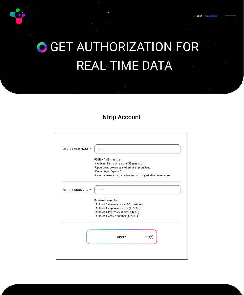
The NTRIP username is a string of 8 to 30 characters. It was okay to use the NTRIP user name as a nickname and the password as archive data. After e-mail authentication again, you will be able to use NTRIP.
First, we need finding out the observation station and its NTRIP mount point. We can find them from the web page that displays a very colorful globe.
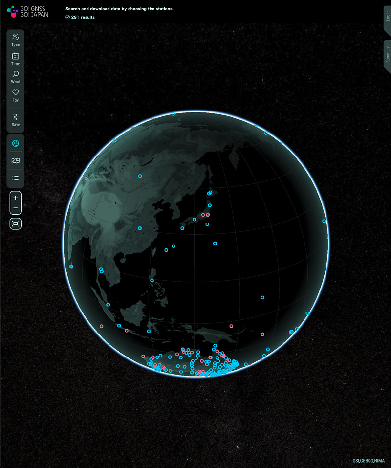
When I turned the display of the earth with the mouse, the starry sky in the background moved and the sun appeared like Google Earth. I searched for a familiar Japan.
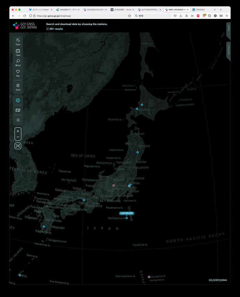
The target this time is Hachijojima, a remote island in Tokyo.
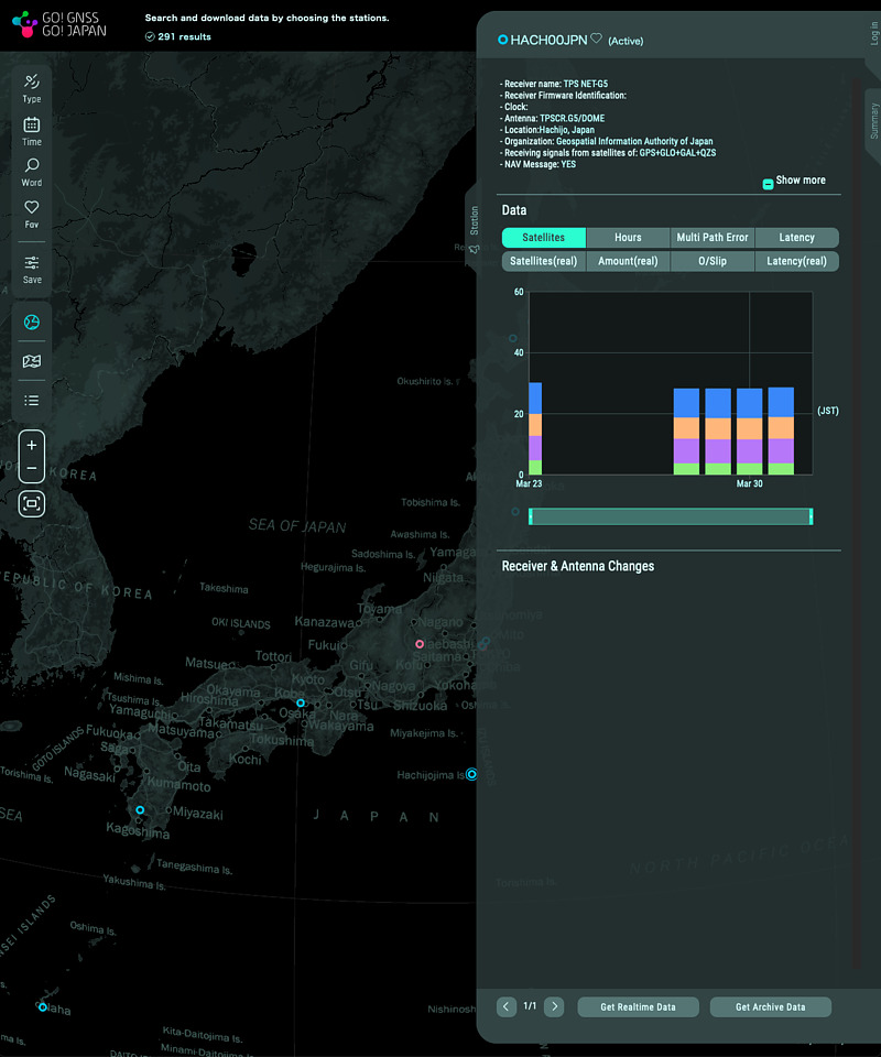
It turns out that the mount point is HACHI00JPN. It says that it uses TOPCON’s NET-G5 receiver.
I used RTKLIB’s str2str application and QZS L6 Tool to see the observation results. The address of NTRIP Caster is ntrip.go.gnss.go.jp.
str2str -in ntrip://username:password@ntrip.go.gnss.go.jp/HACH00JPN 2> /dev/null | showrtcm.py
I was able to see the following observation results in real time.
RTCM 1077 G MSM7          G01 G03 G07 G08 G14 G17 G21 G27 G30
RTCM 1087 R MSM7          R03 R04 R05 R09 R10 R11 R19 R20 R21
RTCM 1097 E MSM7          E01 E07 E13 E18 E21 E26 E31 E33
RTCM 1117 J MSM7          J02 J03 J04 J07
RTCM 1127 C MSM7
RTCM 1019 G NAV           G02 svh=00
RTCM 1020 R NAV           R09
RTCM 1044 J NAV           J02 svh=00
RTCM 1046 E I/NAV         E11
RTCM 1077 G MSM7          G01 G03 G07 G08 G14 G17 G21 G27 G30
RTCM 1087 R MSM7          R03 R04 R05 R09 R10 R11 R19 R20 R21
RTCM 1097 E MSM7          E01 E07 E13 E18 E21 E26 E31 E33
RTCM 1117 J MSM7          J02 J03 J04 J07
RTCM 1127 C MSM7
RTCM 1019 G NAV           G03 svh=00
RTCM 1020 R NAV           R10
RTCM 1044 J NAV           J03 svh=00
RTCM 1046 E I/NAV         E12
We can see not only observation data (MSM7: Multiple Signal Message 7) of GPS, quasi-zenith satellites, Galileo, and GLONASS, but also see these navigation data. It also includes receiver information (RTCM 1033), and I was notified that the receiver name is TOPCON TPS NET-G5 and the antenna name is TPSCR.G5 DOME. There was no coordinate data (RTCM 1005 or 1006). We can download CSV file including mount point and observation station coordinates on the user page, but the coordinate resolutions are only 4 digits after the decimal point. Some of the MSM7 messages were from BeiDou, but the content was empty. Real-time data observation is fun.
Conclusion
The Cabinet Office of Japan started the GNSS integrated data sharing system “MIRAI”. The new MADOCA-PPP (Multi-GNSS Advanced Orbit and Clock Analysis - Precise Point Positioning) will utilize this MIRAI.
According to the user page, 291 observation stations are currently registered and 256 stations are in operation. In particular, there are many stations in Australia. I found 5 stations in Antarctica. The number of registered users was 81, the number of logins for the past 24 hours was 41, the number of real-time data connections was 4, the amount of real-time download was 111 MB, and the amount of web download was 344 MB.
Let’s think about a fun way to use MIRAI.