Grid locations of CLAS augmentation signal of quasi-zenith satellite
Introduction
The quasi-zenith satellite (QZS, the pet name is Michibiki) broadcasts not only positioning signals but also signals that improve its positioning accuracy (augmentation signals). CLAS (centimeter level augmentation service) is one of the augmentation signals. This augmentation information includes two types of information, namely, one for satellites and another for regions.
The former is the correction of the satellite position information and internal clock information already broadcast from the satellite, and the internal clock and coordinate correction of GPS, QZS, and Galileo are transmitted.
On the other hand, for the latter, the amount of radiowave delay due to the ionosphere at the representative point in Japan is transmitted. The information from the satellite expresses the amount of radiowave delay in the world with a single parameter, so we can expect the accuracy to be improved by this augmentation information.
I looked up this latter grid information. CLAS divides Japan’s land into 19 grids network identifications (NIDs) (updated on 2022-07-02). The grid information described in the CLAS specification IS-QZSS-L6-004 is only the coordinates, and it is not possible to know which region the information is. Therefore, I plotted these coordinates on the GSI Maps (electronic national land Web).
The bathymetric contours are derived from those contained within the GEBCO Digital Atlas, published by the BODC on behalf of IOC and IHO (2003) (https://www.gebco.net)
Shoreline data is derived from: United States. National Imagery and Mapping Agency. “Vector Map Level 0 (VMAP0).” Bethesda, MD: Denver, CO: The Agency; USGS Information Services, 1997.
On page 97 of IS-QZSS-L6-004, it is shown that the amount of radiowave delay at multiple points in the grid is weighted by that distance in order to obtain the amount of radiowave delay at a specific point.
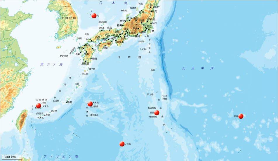
NID 1: Islands in Okinawa
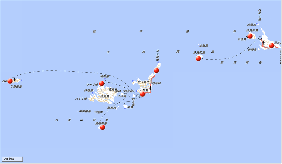
It represents islands such as Miyako Island, Iriomote Island, Yonaguni Island, Hateruma Island in the south of the main island of Okinawa. There are 8 points in total.
NID 2: Islands in Kagoshima and the area around the main island of Okinawa
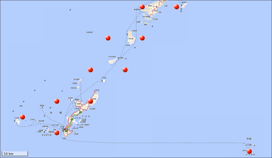
It represents Amami Oshima, Tokunoshima, Okinoerabujima, and the main island of Okinawa. There are 11 points in total.
NID 3: Kyushu, Yakushima, Tsushima
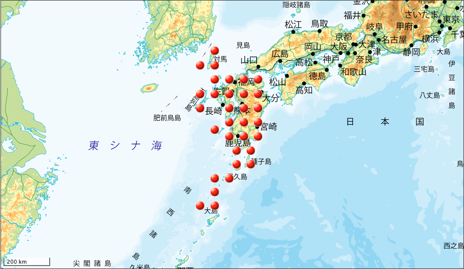
It represents from Tsushima to the northern part of Amami Oshima. There are 32 points in total.
NID 4: Shikoku region
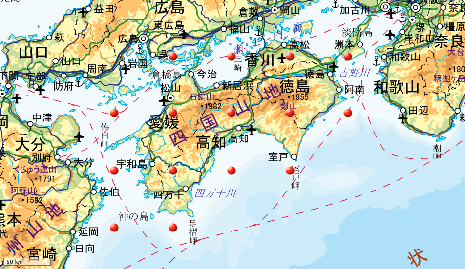
It represents Shikoku and its surroundings. All 15 points.
NID 5: Chugoku region and Oki Islands
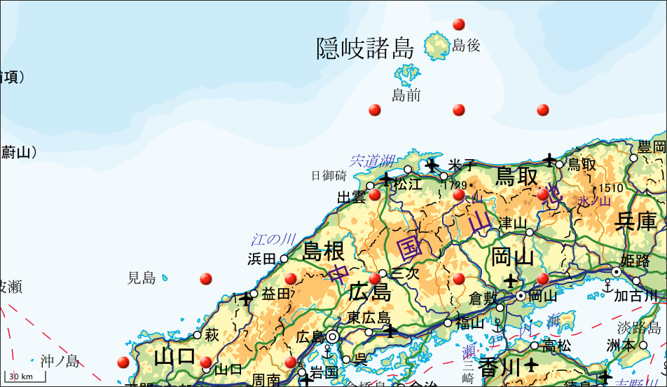
It represents the Oki Islands in the Chugoku region and Shimane prefecture. All 15 points.
NID 6: Chubu region
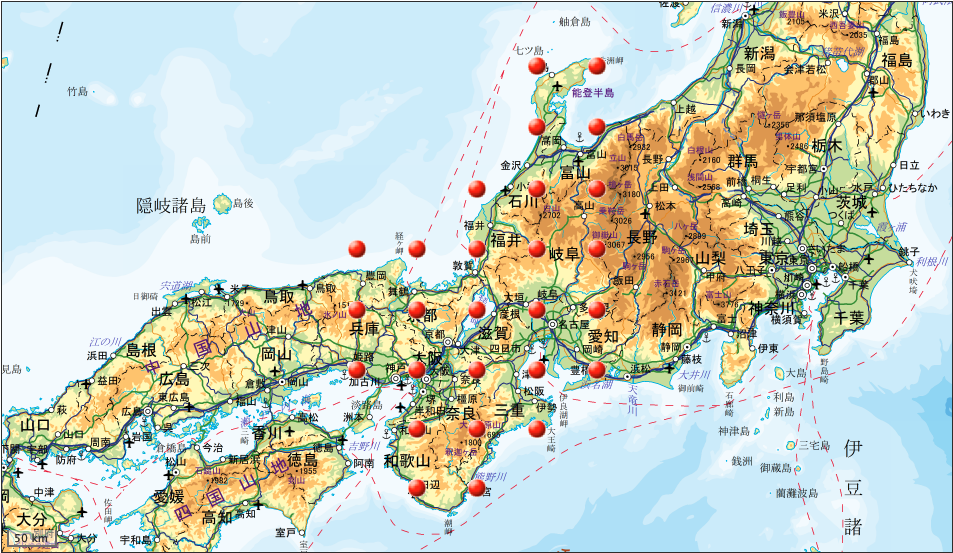
It represents the Chubu region. There are 27 points in total.
NID 7: Kanto region
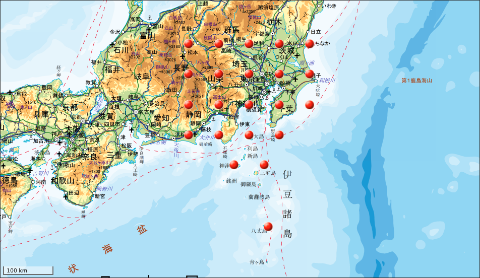
It represents the Kanto region. There are 22 points in total.
NID 8: Southern Tohoku region
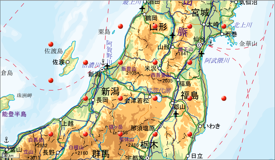
It represents the southern part of the Tohoku region. There are 20 points in total.
NID 9: Northern Tohoku region
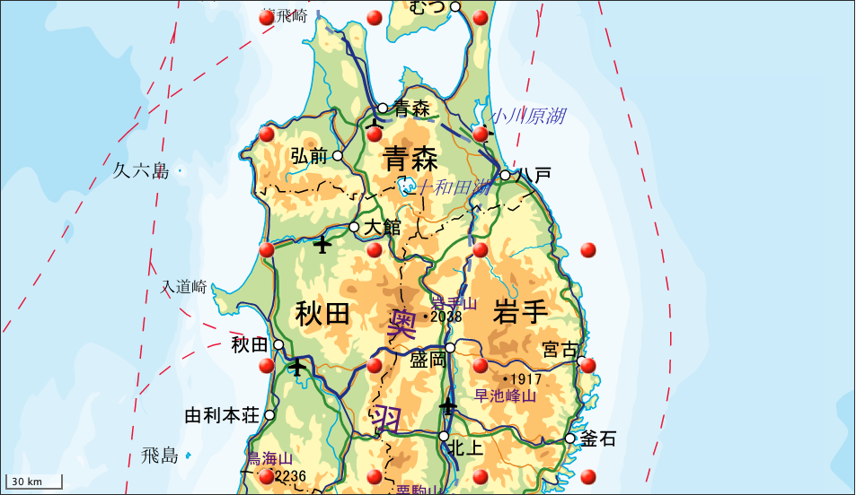
It represents the northern part of the Tohoku region. There are 18 points in total.
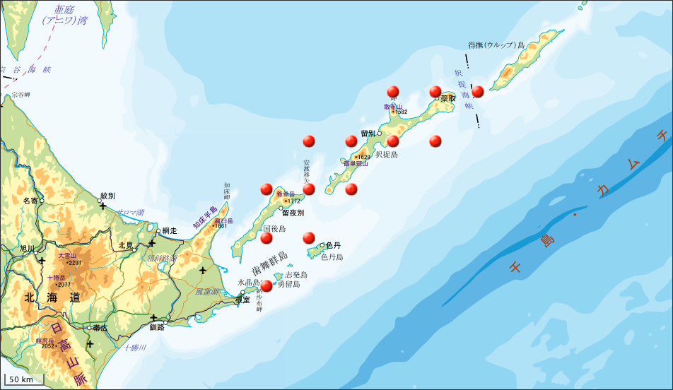
NID 10: Southern Hokkaido
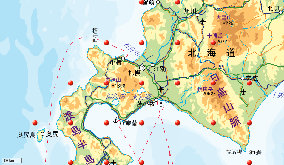
It represents the southern part of Hokkaido. There are 23 points in total.
NID 11: Northern Hokkaido
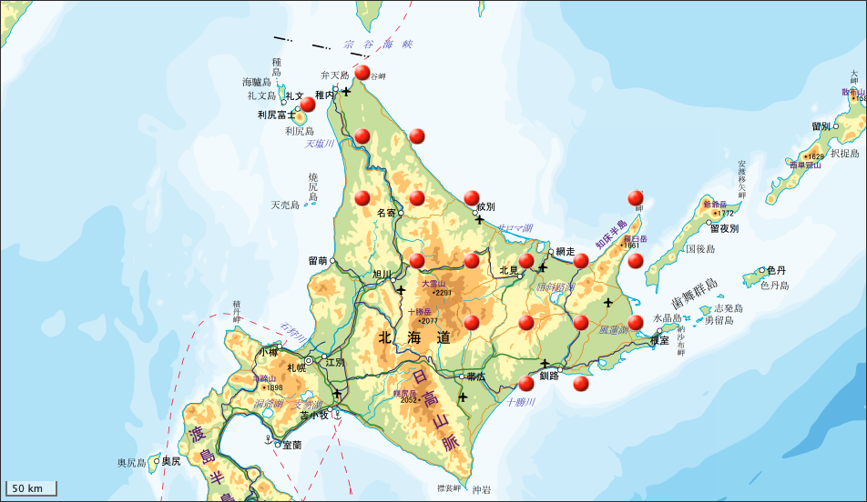
It represents the northern part of Hokkaido. There are 19 points in total.
NID 12: Ogasawara Islands
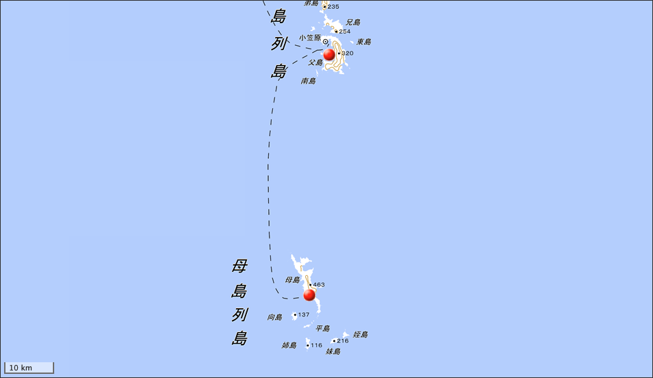
One point for Chichijima in the Ogasawara Islands and one point for Hahajima, for a total of two points.
NID 13: Islands of Japanese territory
The grid network ID has beed removed since the issue of IS-QZSS-L6-004 dated on July 14, 2021. (update on 2022-03-18)
It represents the islands of Japanese territory. There are 13 points in total.
NID 14-19: Japan islands
These NIDs have also beed removed since the issue of IS-QZSS-L6-004 dated on July 14, 2021. (update on 2022-03-18)
Islands in Japan. Each NID contains one grid point.
Conclusion
The CLAS augmentation message is generated based on the GNSS reference station data of the Geographical Survey Institute of Japan. It is interesting that the augmentation message that point is far from the neighboring GNSS reference point is generated virtually. There are some places on the grid that are very difficult to reach at this time. I remember when I was in junior high school, I was fascinated in communicating with amateur radio DX pedition (distance expedition) stations.